The Underground Transit Challenge
Subway and metro systems across Africa's growing urban centers face unique navigation challenges that directly impact ridership and operational efficiency. Research from the International Association of Public Transport indicates that 71% of first-time subway users experience difficulty navigating underground systems, leading to reduced public transit adoption and increased surface traffic congestion.
The challenge intensifies in underground environments where GPS signals are unavailable, cellular connectivity is limited, and complex multi-level layouts create disorientation. Traditional static signage proves inadequate for dynamic subway environments where service disruptions require alternative routing, platform changes occur frequently, and emergency situations demand rapid passenger guidance.
Impact on Transit Operations
Digital Wayfinding: The Transit Revolution
Leading subway systems globally have recognized digital wayfinding as essential infrastructure for ridership growth. London Underground reported 45% improvement in passenger flow efficiency and 32% reduction in platform congestion after implementing indoor navigation systems. Similar results at Tokyo Metro and New York MTA demonstrate the measurable impact of technology-enabled underground transit navigation.
Effective subway navigation systems require several critical components: offline functionality for underground environments, integration with real-time service information, crowd management capabilities, and accessibility features that serve passengers with diverse mobility needs and language requirements.

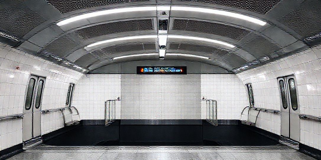
Smart subway navigation improves commuter experience and reduces congestion
Waide's Subway Navigation Solution
Waide Mobility addresses these underground transit challenges through our comprehensive AI-powered indoor mapping platform. Our solution transforms existing subway station layouts into interactive, accessible digital maps that provide precise location services and turn-by-turn navigation across complex multi-level underground facilities.
The platform leverages advanced computer vision and machine learning to process station blueprints, converting them into geo-referenced digital maps with centimeter-level accuracy. This enables reliable underground positioning and real-time wayfinding assistance for passengers navigating subway systems.
Subway-Specific Capabilities
Offline Navigation: Fully functional underground navigation without cellular or GPS connectivity, essential for subway environments.
Service Integration: Real-time connection with transit management systems for service updates, delays, and platform changes.
Exit Planning: Intelligent routing to optimal exits based on passenger destinations and current station conditions.
Emergency Protocols: Rapid evacuation routing and emergency response coordination for underground safety situations.
Comprehensive Platform Integration
Beyond basic navigation, Waide's platform integrates with broader transit management ecosystems. Our Smart Building Integration connects with ventilation systems, crowd sensors, and security infrastructure to optimize passenger safety and comfort in underground environments.
The platform's Indoor Proximity Advertising capabilities enable transit authorities to deliver contextual information: retail promotions in station commercial areas, public service announcements, and wayfinding assistance based on passenger location within the subway system.
For multi-line subway networks, our analytics provide insights into passenger flow patterns, identify bottlenecks in station design, and support infrastructure planning for growing urban transit systems.
Implementation and Deployment
Waide's deployment methodology minimizes disruption to subway operations through a phased approach. Station floor plans are uploaded to our AI digitization platform at maps.waidemobility.org, where they're converted into interactive maps within 3 weeks depending on venue size.
System integration connects with existing transit management systems, passenger information platforms, and emergency response systems through RESTful APIs. QR codes are strategically placed at station entrances and platform areas, while mobile applications are configured for offline passenger access.
Our flexible pricing accommodates systems of all sizes: Starter packages for small metro systems (up to 10 stations), Professional packages for medium-sized networks (10-50 stations), and Enterprise solutions for major subway systems (50+ stations) with full API integration and custom development.
Technical Specifications and Requirements
The platform maintains compatibility with iOS 12+ and Android 8+ devices, ensuring broad accessibility across passenger demographics. Offline functionality provides 99.9% uptime reliability, critical for underground environments where passenger safety depends on consistent navigation availability.
Sub-meter positioning accuracy enables precise navigation to specific platforms and exits. Cloud-based map management allows real-time updates for service changes, while RESTful API integration supports seamless data synchronization with existing transit systems.
Underground-optimized positioning technology ensures reliable navigation without GPS or cellular connectivity requirements.
The Future of Subway Navigation
As African cities continue urbanizing, subway systems become essential for sustainable transportation. Waide's platform scales from small metro networks to major subway systems, supporting the continent's growing public transit infrastructure.
Transit authorities can begin implementation immediately through our streamlined five-step process: uploading floor plans at maps.waidemobility.org, AI digitization within 3 weeks depending on venue size, configuration of navigation settings and transit integration, QR code deployment with staff training, and launch with ongoing optimization support.
The investment in digital wayfinding delivers measurable returns through increased ridership, improved passenger satisfaction, enhanced safety compliance, and optimized subway operations.
Transform Your Subway System
Join transit authorities across Africa implementing Waide's navigation platform.